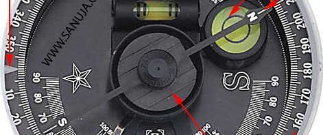
It is essential for a Earth Scientist to be skilled at using the tools of the trade. From day one, students are trained to use the Brunton Compass, a highly popular measuring tool. I am very proud to say it was first designed and developed by a Canadian Geologist, David W. Brunton. If properly used it is a great tool for taking precise geological measurements within few degrees or meters of accuracy.
Tag Archives: academic
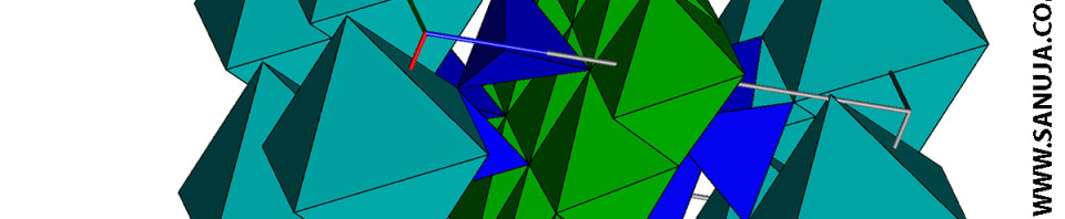
Silicate Mineral Structures
Click on the image for larger high resolution file.
Dark blue is Silicate Tetrahedra, green is bonds and the light blue is sodium.
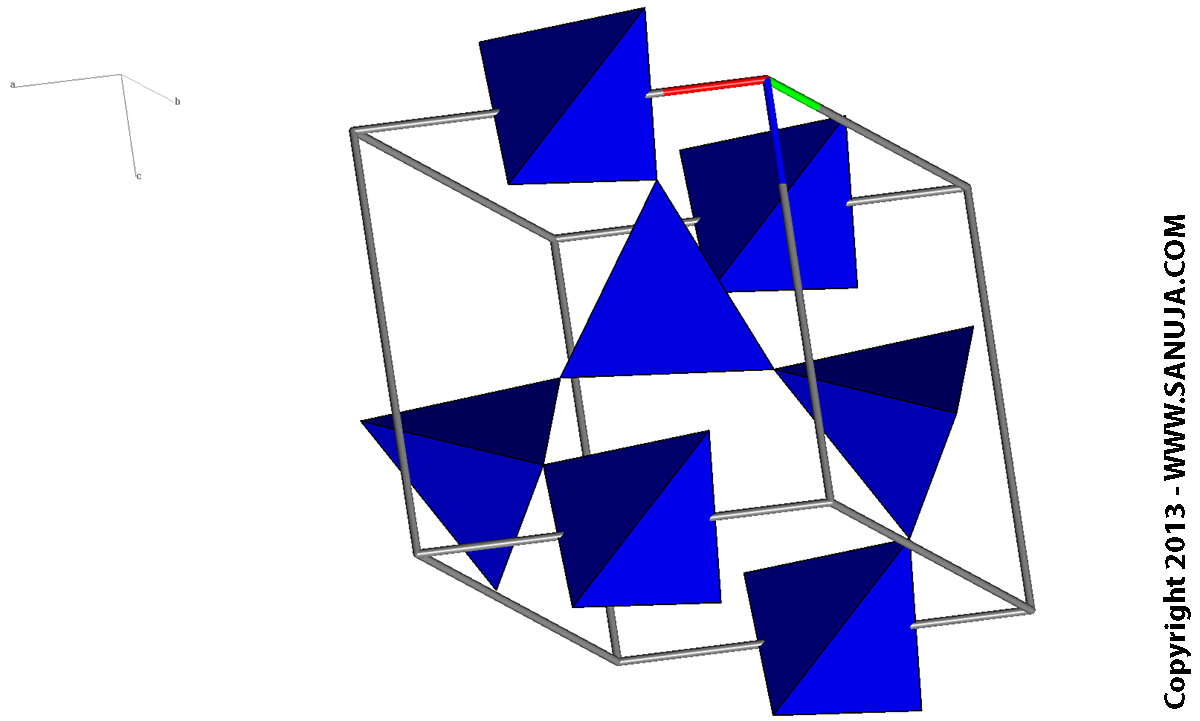
The isolated tetrahedra is a group of silicates in which the crystal structures have no shared oxygen between them. Therefore minerals like Olivine and Garnet are held together by the attaraction force between silica tetrahedra and the surrounding cat ions. This is the least polymerized type.
Improving spatial visualization skills
There are thousands of research reports written on 2D and 3D thinking skills on the internet. You can read them all, but I do not believe absorbing those highly academic reports would make any difference for improving your ability in spatial visualization. The main message in all those reports is; the ability to understand 3D structures are very important to Science and Engineering students.
How to read Geological Maps
For someone who is new to Geology, reading highly technical maps could be a challenge. I remember even I had trouble reading data off of maps when I was in first year Geology class. It is nothing to be shamed of because I know even the most seasoned Geologists who read their maps wrong. But the difference between a skilled Geologist and a lay person is that a Geologist would be able to find his/her own mistake. This article will introduce you to the most fundamental aspects of Geologic maps.
Whose fault is that?
No, I am not going to finger point. This is about Geological faults and not about your faults. Joke aside, the different types of fault anatomies are very impotent for understanding the nature of the fault, it’s history and the even the future. The Structural Geology is one of the branches in Geoscience in which scientists are specifically concerned about the fault propagation and the anatomy. The behaviors of faults are important structures for industry (specially energy) and for urban planing. For those of you who are not familiar with Geology, this article may provide some insight into fault structures in general. I am not going to discuss the techniques of fault analysis, because my goal is to educate the general public. But if you are a “Geology minded” person, pleased read Fault Displacement Vectors for more in-depth view.
Structures Tell a Story
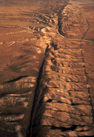
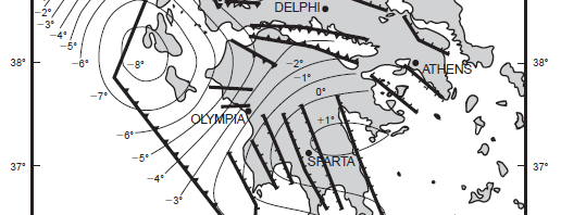
The structures we observed in the field records the history of geologic activities of the past and may provide insight into the future. For example, based on structures in the San Andreas Fault, today we know it’s sense of movement, history and we can predict the future.
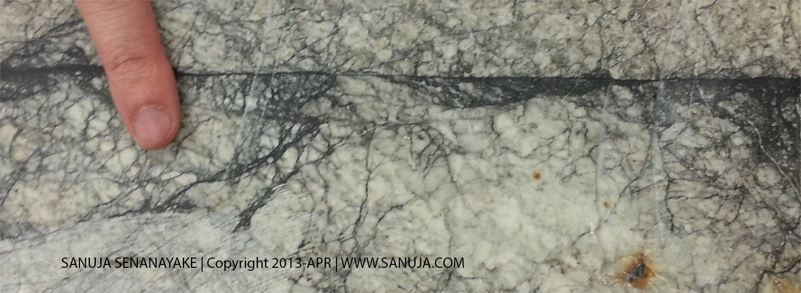
For someone who is new to Geology (like the undergrad students), hands on experience may not be an option due to logistics (specially if you live in countries which cannot afford to send you out to the field). But don’t get discourage we can use rock samples with fault structures to widen our understanding of faults. Before the GPSes (Global Positioning System) are used to track and record movements of materials, we were able to determine the history using slickensides, type of rock, geologic features and many other variables. They are still in use today because those fundamentals have always proven to provide an accurate picture. In fact, these so called “old methods” are useful when you don’t have physical access to a site. Today even large companies that outsource the geologic work sometimes send samples to a lab, rather than taking their professional to the field.
Different structures, a lot of information
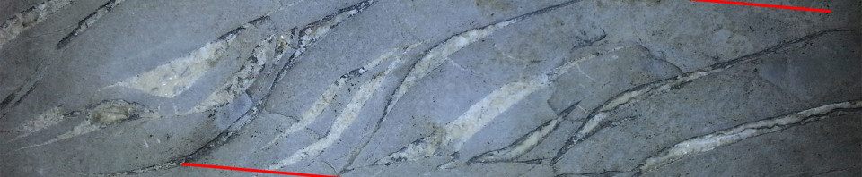
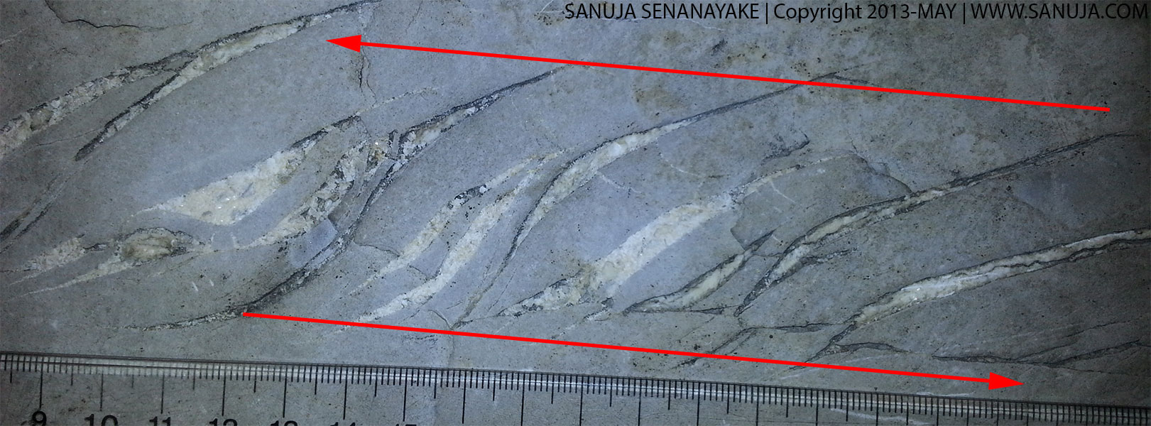
Tension gashes are develop as a result of differential stress within the fault zone and useful for determining the orientation of principle stresses and the sense of movement. It usually form a “S” or “Z” shaped structures. On a vertical plain, if the gash is like and “S”, the top block is moving to the left. If the gash is like a backwards-S then the top block is moving to the right.
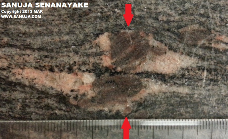
Pseudotachylite are another type of structure which they form as a result of flash melting. The friction and the tension within the fault, causes rock surface in the fault to melt. These melted materials spread along the fault and injected into the two fault blocks. They are fined grained material and are used to identify fault zones. However, they are not always a common occurrence in fault zones. You will most likely come across tension gashes than this type of structure.
Pressure shadows can be used for understanding the force regimes. These indicate the direction in which the maximum magnitude of the compressional forces are acting on a rock body.
I will update this page with few more geological characteristics of faults. Until then, happy georgasm!